NOTE: The Trailhead is situated at the top of Mangan’s Lane. The 2km old lane is narrow and unsuitable for vehicular traffic but provides wonderful views of the village below. Walking to the trailhead is recommended (from the Village Square or GAA Carpark) – see directions below.
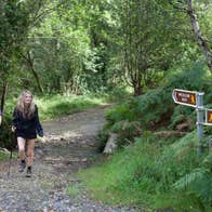
A-B. From the trailhead follow the purple (and green and blue) arrows along Mangan’s Lane. The green and blue arrows are for shorter loops. Pass a gateway and reach a 3-way junction where you join the Wicklow Way (a long distance route marked with yellow ‘man’ and arrows). The loop proper begins here - you will return to this point from the opposite direction - for now, turn right. Ascend to reach a memorial cross where the green loop turns left - you continue straight following the purple (and yellow and blue) arrows.
B-C. For the next 2km the loop follows an old laneway - and exits onto a surfaced roadway at a ford where you turn left. Stay on the surfaced road for approx 1km to reach an old schoolhouse building (on your left) Here, the blue loop turns left - you stay on the road, following the purple arrows and the Wicklow Way. Follow the surfaced road for another 1km to reach a right bend where a stile (on your left) takes you onto a forestry track. Ascend to reach a turntable where you turn right onto a forestry roadway. Follow the roadway for 1km to rejoin surfaced roadway at a ‘crossroads’ - veer left here, leaving the Wicklow Way as you do.
C-D. Follow the purple arrows along the road for 750m to a junction with a farm laneway on your left - turn left, cross the driveway to a farmhouse, and continue along the laneway to reach a stile which takes you into farmland and a grassy laneway. Stay on this laneway as the loop ascends for almost 2km to cross a ditch and enter a section of forestry. Follow the purple arrows for 2km along (first) forestry road and (then) the edge of forestry to reach a stile which exits onto open hillside again. Turn left, and follow the edge of forestry (on your left) downhill for 200m to rejoin the green and blue loop (coming from the opposite direction). Turn right here.
D-A. Follow the green, blue and purple arrows downhill for 500m to join a green track and swing left. This track takes you to a T-junction with the Wicklow Way - turn left here, follow the roadway for 100m to reach the 3-way junction at A above - this time proceed straight ahead - it’s only 200m back to the trailhead.
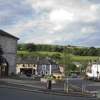
Tinahely is a market village in County Wicklow. It lies south of the Wicklow Mountains in a valley of the River Derry - close to the borders of Co. Carlow and Co. Wexford. In addition to this looped walk (which is one of a trio), walks have been developed in Tomnafinnoge Wood (one of the last remnants of the oak woodlands which once blanketed south Wicklow). The Wicklow Way (an approved long-distance route) also passes close to this picturesque village.
Trail details
- Type:
- Walking Trail
- Location:
- Tinahely Loops
- Grade:
- Strenuous
- Format:
- Loop
- Length:
- 12.30km
- Ascent:
- 500m
- Dogs allowed:
- No


